
A team of Monmouth University computer science students has created a mobile app version of the Mid-Atlantic Ocean Data Portal, giving users access to a sea of coastal and ocean maps wherever they may be. The app is available for free download on Google Play and the Apple App Store.
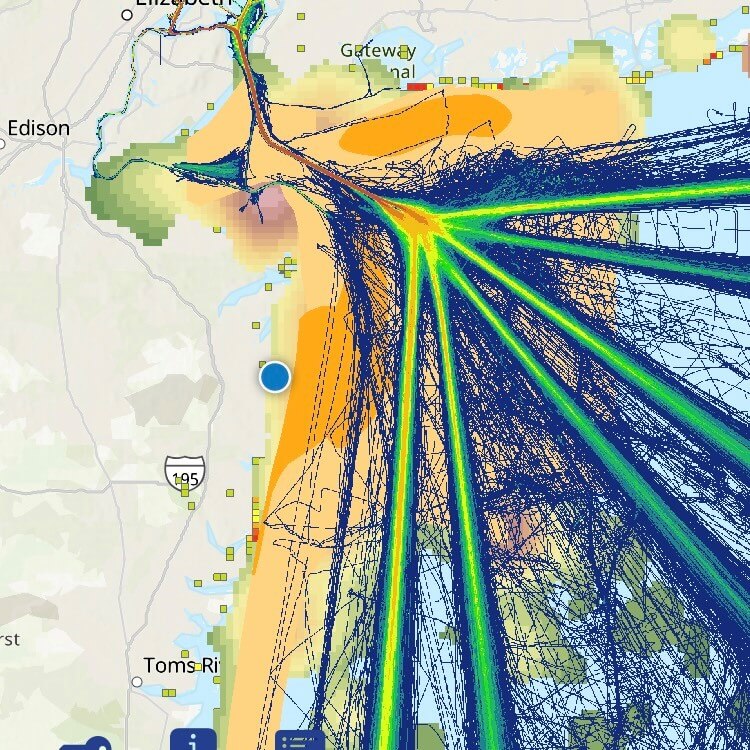
The Portal (portal.midatlanticocean.org) is a publicly accessible GIS site containing over 6,000 interactive maps showing vessel traffic patterns, marine life distributions, commercial fishing grounds, recreation hot spots, offshore infrastructure locations, and much more. Maintained by the Mid-Atlantic Regional Council on the Ocean (MARCO) – a partnership of five states from New York to Virginia working to enhance the vitality of the region’s ocean ecosystem and economy – the site has become an influential tool for informing ocean management decisions and a valuable educational resource. However, due to the complexity of its GIS web app (called “Marine Planner”), the Portal has limited compatibility with smaller handheld devices.
May 2023 graduates Nolan Beagell, Chelsea Spencer and Ava Taylor set out to build a solution during a senior project course taught by Specialist Professor Raman Lakshmanan. As part of the course, teams can choose a capstone project from a pool of ideas proposed from external clients. Urban Coast Institute (UCI) Communications Director Karl Vilacoba, who manages the Portal technical team, and Ecotrust Senior Software Developer Ryan Hodges, the site’s developer, floated a few possibilities related to the Portal, including developing new tools on the site and creating an app. The team picked the latter and collaborated with Vilacoba and Hodges to get it started.
The group unveiled a beta version of the app for users to test and share their feedback at MARCO’s 2024 Mid-Atlantic Ocean Forum in New York City. MARCO was impressed by what it saw, and the organization provided grant funding to the UCI to finish the job.
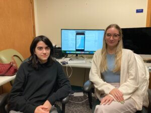
Under the direction of Lakshmanan, Taylor was contracted after graduation to continue her work along with Monmouth computer science senior Anjali Narang. The duo refined the technology out of the Computer Science and Software Engineering Department’s Mobile Apps and AR/VR Lab in Howard and Edison Halls, with Taylor leading the iOS version’s development and Narang the Android product.
Although some advanced maps and capabilities from the desktop site are currently not available on the app, it does contain new functionalities that are unique from the Portal. Among them are a GPS indicator that shows where you’re located in real time on the map, the ability to swipe right to unlock commands, and options to select “favorite” or “active” layers, which serves as a simple alternative to the Bookmarks tool on the desktop site. Taylor and Narang said many design choices were made to put an iPhone and Android twist on what the Portal does.
“The user experience on a phone is much different than a computer, so we wanted to replicate instinctual movements, icons, and things you’d find on other apps we were familiar with,” Taylor said. “We wanted to take the website and give it that iPhone feel. We grew up with this technology and knew what would feel intuitive for a user.”
Their faithful attention to the details of iPhone and Android products led them to make the versions slightly different. For example, certain button icons and color conventions that are commonly found on one or the other were adopted.
“I’ve worked on three apps for Android that were all based on an iOS app, and every time it would look slightly different,” Narang said. “If I tried to make it look exactly the same, it just wouldn’t feel right.”
Lakshmanan said the project was the most rewarding his students have ever worked on in terms of delivering the full experience of creating a product for a client and advancing it to the market. The team viewed their opportunities to collaborate with a seasoned software developer in Hodges and to enhance the product based on constructive input from multiple in-person conferences and MARCO meetings as particularly valuable.
“They got to learn what it takes to get real products out into the field,” Lakshmanan said. “You can’t teach that in a class, per se. A project like this that gives them the best hands-on experience.”
MARCO is excited about the potential new audiences and uses of its data that the app will unlock.
“Using the MARCO app, a beachgoer can browse our maps, for example, to identify something interesting they see offshore, or a family out fishing on their boat can look for nearby reefs or wrecks,” MARCO Executive Director Avalon Bristow said. “Uses like these were limited in the past because people would have needed a computer and Internet access.”
More information about the app and instructions for using it can be found here. If you have questions or feedback on the app, please email portal@midatlanticocean.org.