

Urban Coast Institute Communications Director Karl Vilacoba provided an online tour of the Mid-Atlantic Ocean Data Portal in a Nov. 14 edition of the Mid-Atlantic Regional Council on the Ocean’s “How Tuesday” webinar series. The session is ideal both for newcomers and returning users seeking a refresher on the Portal’s maps, tools and features.
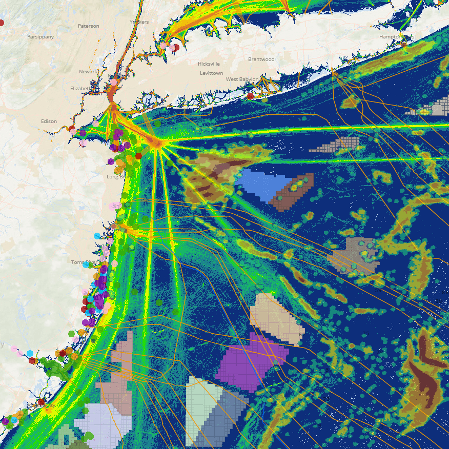
The Portal is a free and publicly accessible GIS mapping and information tool focused on ocean areas from New York through Virginia. It features over 6,000 interactive maps showing marine life distributions, offshore wind proposals, fishing grounds, wreck and reef locations, vessel traffic patterns, recreation hot spots and much more. Vilacoba serves as the project manager for the technical team developing the site.
For more information about the Portal, or if you’re interested in scheduling a training for your agency or class, contact Vilacoba at kvilacob@monmouth.edu.