Urban Coast Institute Communications Director Karl Vilacoba worked with members of the Mid-Atlantic Committee on the Ocean’s offshore wind work group to create a miniseries of story maps offering an educational look at the basics of offshore wind energy transmission cable siting.
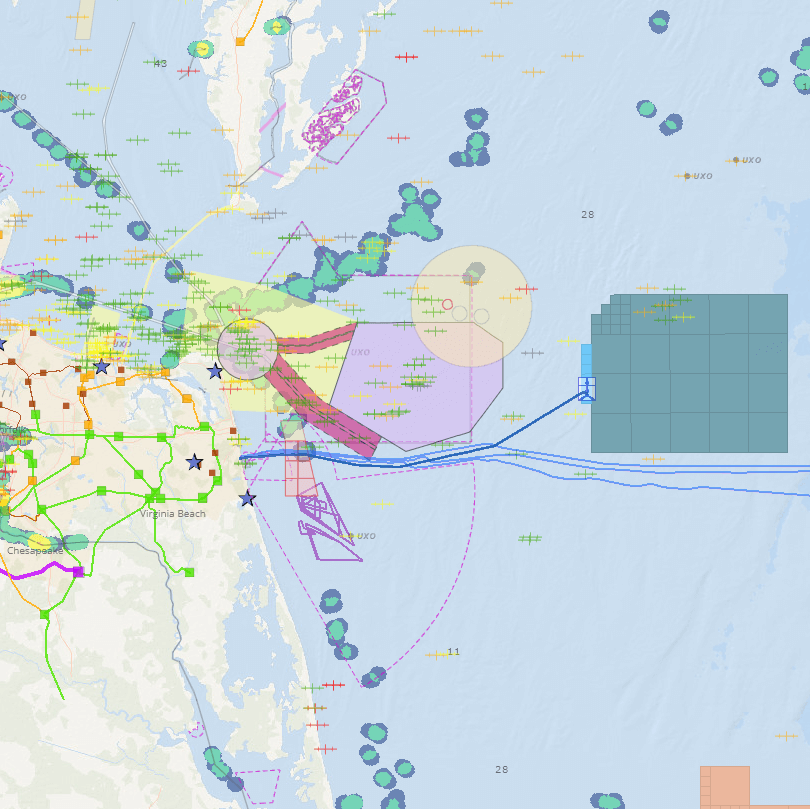
In one of the “Ocean Stories” features on the Mid-Atlantic Ocean Data Portal, Vilacoba interviewed Dominion Energy Environmental Services Environmental Technical Advisor Scott Lawton about some of the major factors involved in the design of the power cable route connecting to the first two offshore wind energy turbines in federal waters. The story and its scrolling data maps detail the need to steer clear of hazards and other ocean uses such as Naval training areas, fishing activity, shipwrecks and telecom cables while planning the cable alignment, which runs from Virginia Beach to the Coastal Virginia Offshore Wind pilot turbines 27 miles offshore.
The other piece introduces the planning considerations involved with designing power cables in federal waters. Vilacoba worked with staff from the Mid-Atlantic Regional Council on the Ocean, Delaware Department of Natural Resources and Environmental Control, National Oceanic and Atmospheric Administration, New Jersey Department of Environmental Protection, New York State Department of State, U.S. Army Corps of Engineers, and U.S. Department of Energy to create the piece.
A non-mobile device is recommended for best viewing.