With the 2020 hurricane season officially underway, the UCI partnered with a team of federal agencies and research institutions to deploy a pair of Navy research gliders that will shed new light on the interactions between the ocean and powerful storms that pass through the New York Bight.
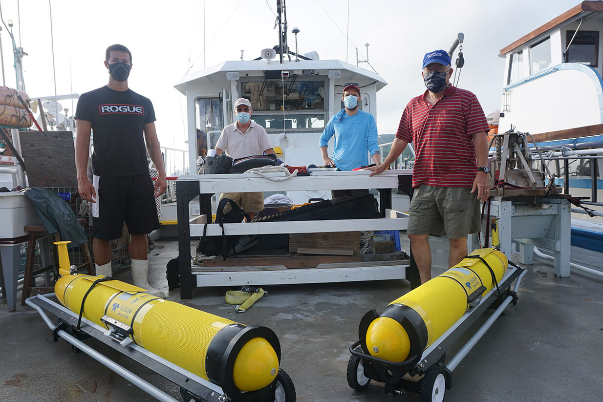
The gliders were launched from Monmouth University’s research vessel Heidi Lynn Sculthorpe at locations between the shipping lanes that approach New York Harbor. The crew included (seen above from l-r) Monmouth student Bryce McCall, Rutgers University scientists Scott Glenn and Travis Miles, UCI Marine Scientist Jim Nickels, and (not pictured) UCI Communications Director Karl Vilacoba.
The gliders will cruise the waters between the continental shelf and the coast from now through late October, collecting data on water conditions and transmitting it to scientists on the shore. Of particular interest is the influence that cooler waters at the bottom of the ocean have on storms once they “upwell,” or rise to mix with warmer surface waters as the ocean churns. Warm waters are known to fuel hurricanes, but the full degree with which colder waters slow and dissipate the storms is still under study. The gliders enable the researchers to safely measure those dynamics directly from the violent, roiling waters beneath a hurricane, and ultimately improve storm modeling. Scroll below to learn more with our photographic trip diary.
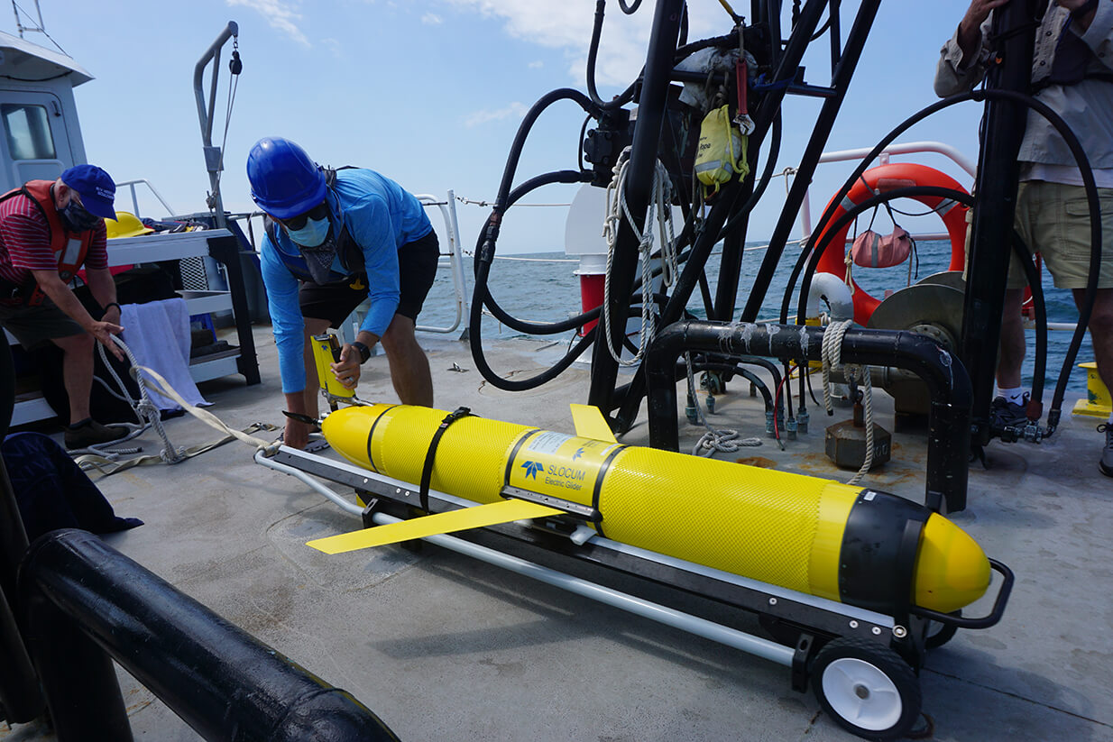
Above, Miles gets set to deploy the first glider roughly 20 miles east of Asbury Park, New Jersey. He’ll wheel the equipment to the edge of the vessel using a special hand truck with rails, angle it downward, and release the torpedo-shaped glider to plunge into the sea. It will quickly float back to the surface.
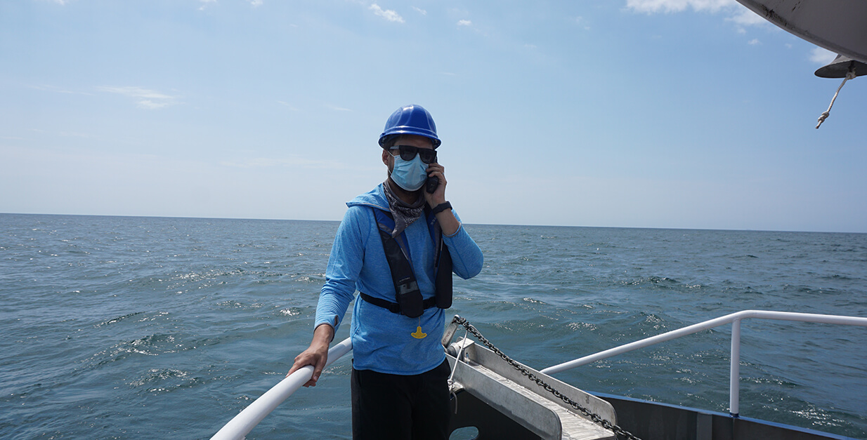
With eyes on the glider, the team will use a satellite phone to call the Naval Oceanographic Office at the John C. Stennis Space Center in Mississippi. From that site over 1,000 miles away, researchers can command the drone to carry out a battery of tests, including dives, timed cruises and data collection.
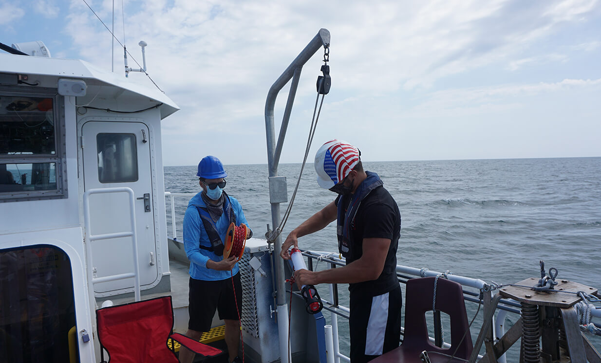
In the meantime, the team will take some readings in the water with their own equipment to make sure the glider’s data is matching up accurately. Once all of the tests were passed, the Heidi Lynn Sculthorpe headed to its next stop an hour north.
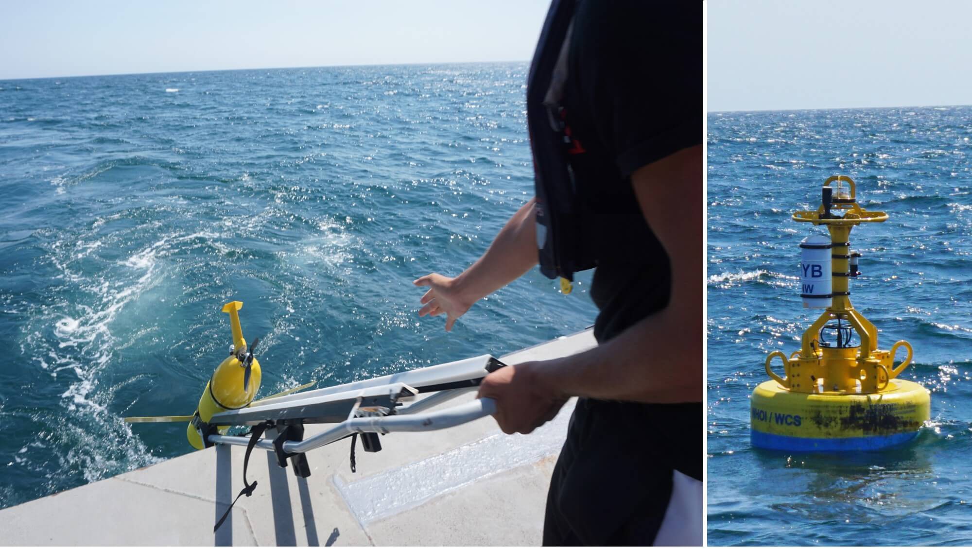
McCall launched the second glider about 15 miles south of Jones Beach, Long Island. From this point, the New York skyline and the high rises of Long Branch and Asbury Park were no longer in view. But over the next few years, these waters will be home to an installation of massive wind turbines that could produce enough renewable energy to power 1 million homes. While sailing, the crew came upon one deep-water buoy (above right) owned by the Wildlife Conservation Society and the Woods Hole Oceanographic Institution, used to gather scientific data.
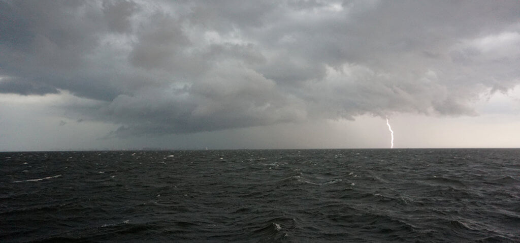
As the Heidi Lynn Sculthorpe embarked on its 3-hour trip back to Atlantic Highlands, the waters suddenly grew rough and Capt. Nickels’ radio buzzed with warnings to mariners. The 100-degree, ultra-humid air was about to burst open with thunderstorms and 40 knot winds. Nearing Sandy Hook, the crew was treated to a dazzling show of fork lighting and ominous cloud formations over New York City.
The glider deployment was carried out under the auspices of the Mid-Atlantic Regional Association Coastal Ocean Observing System (MARACOOS). Several other gliders were launched at other locations along the Atlantic Coast as part of the multi-year project. Additional partners include the National Oceanic and Atmospheric Administration (NOAA), the Integrated Ocean Observing System (IOOS) and several other academic institutions.
Watch our video below chronicling last year’s glider deployment aboard the Heidi Lynn Sculthorpe.
