The Big Dig
On the hunt at Sandy Hook for relics of the past—and ways to protect them in the future.
To the untrained eye, the archaeological site doesn’t look like much. An undisclosed, forested stretch of beach on the thin spit of Sandy Hook, littered with leaf drop, sprawling poison ivy, and a bounty of underbrush. That’s about the extent of it. But when one hears the story of this site and what lies beneath the surface, an entire world emerges.
Here, a bustling tavern and bunkhouse once served scores of sailors and travelers from the late 1700s before it burned down in 1855. Here, an adjacent blockhouse once stood, likely built to house soldiers during the War of 1812. Here, the legendary Sandy Hook Pilots slept and drank and played games in between perilous missions to escort ships safely through a treacherous New York Harbor. Here, long-forgotten artifacts like cups, plates, coins, musket balls, and buttons, embossed with the letters U.S. and buried for centuries, now finally emerge to tell their ghostly stories of a world somehow both ancient and contemporary. Here, a microcosm of the seemingly mundane has been liberated from the ceaseless corrosion of time to shed some light on a greater tale about ourselves.
“Certain people get recorded throughout history. Others not so much. Archaeology gives voice to those other people,” says Assistant Professor of History and Anthropology Adam Heinrich, who helped spearhead an extensive, multidisciplinary dig last summer in an effort to better understand the history of this obscure patch of land while also assessing the extensive beach erosion and sea level rise threatening to wash it away forever.
“It can also show us how rich and colorful history actually is,” Heinrich continues. “It’s not just about the big events and black-and-white photos. Here you had a tavern and young men on the beach passing the time, maybe waiting for the British to attack in 1812, watching the ocean, drinking, playing games. It enriches our past and helps us to understand where we come from and how we’ve moved on.”
Interest in the site goes back about 30 years, when a few Sandy Hook beachgoers found a smattering of 18th-century artifacts in the sand. Intrigued by the discovery, the National Park Service (NPS)—which owns and manages the majority of Sandy Hook—commissioned an archaeological survey of the area in 1982, which eventually unearthed a trove of relics and tried to identify the original foundation of the tavern itself. The artifacts were catalogued and placed in a storeroom on Staten Island, and it seemed like that would be the extent of it.
Then, in 2019, an NPS archaeologist took a Monmouth student out to see the site, and both were struck by the amount of erosion and sea level rise that had taken place over recent decades. The NPS now had a new project in mind, and they wanted to enlist the talents of Monmouth University’s faculty and students to help pull it off.
“The initial project was modest. We were supposed to take old maps from earlier excavations and see how much of the site had been washed away. But we wanted to propose an even bigger project,” says Richard Veit, professor of anthropology and interim dean of the School of Humanities and Social Sciences. It was he and Heinrich who wrote an $80,000 grant proposal to define the boundaries of the site, characterize it more precisely, assess the extent of the erosion and sea level rise, and propose possible ways to protect it for the future.
“It was a thrill to know this site was right in our backyard,” says Veit. “And we knew we could assemble a team that spanned the University. It would also be a fantastic opportunity for students to get field experience while showing them career opportunities in everything from archaeology to cultural resource management to geographic information systems.”
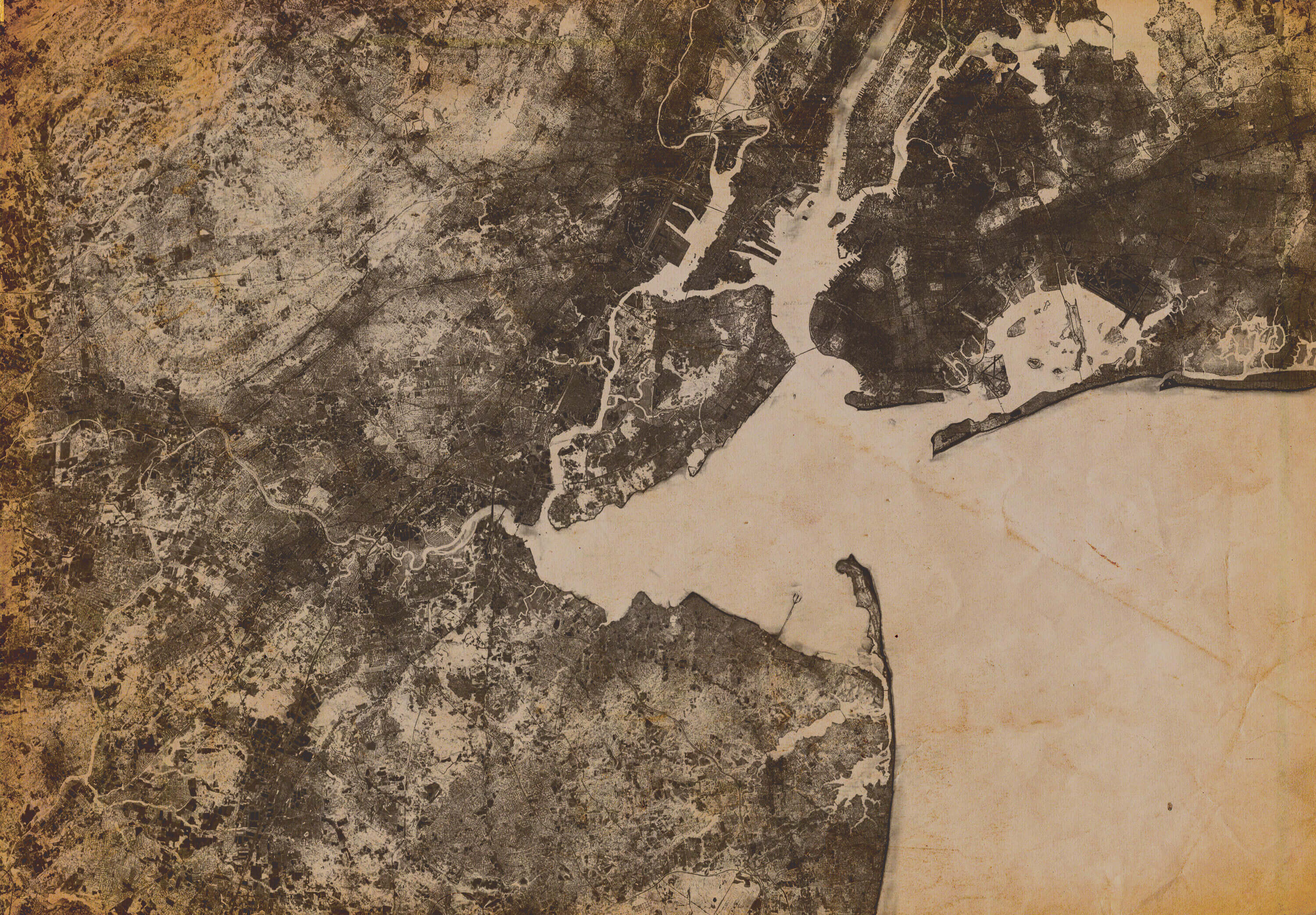
In assembling their team, Heinrich and Veit reached out to Geoff Fouad, assistant professor of geography and program director for Monmouth’s Geographic Information Systems (GIS) Program. Fouad’s task was to examine historic maps spanning more than 300 years and overlay them onto more contemporary cartography to assess precisely how the landscape had changed over time. According to Veit, Fouad brought “an incredible ability to read the land.”
“It’s all about positioning and context,” says Fouad, who also serves as Monmouth University’s official cartographer. “Archaeologists are focused on the site itself, but it’s cartography that brings context. What’s around the site? How does it relate to the broader landscape? And how can we reconstruct the shoreline to see how it’s been changing?”
Another critical member of this multidisciplinary team was Thomas Herrington, associate director of Monmouth’s Urban Coast Institute, who was tasked with figuring out how the NPS might protect the site in years to come. According to Herrington, the primary cause of erosion is the regular removal of sediment from navigation channels at the entrance to New York Harbor—sediment that would otherwise naturally travel south along the western shoreline of Sandy Hook.
“It’s a very interesting site, and it’s really complex. It’s evolving from both natural forces and our anthropogenic influences on the shoreline,” says Herrington. “The sand they remove from New York Harbor used to provide natural protection to the shoreline. But over the last century we’ve taken that sediment out of the system, so the site is becoming more and more exposed to waves during storms or strong currents during surges like we saw with Superstorm Sandy. So it’s in a chronic erosion state now. As the sea level continues to rise, the higher water level allows for the development of bigger waves along the shoreline. All of this forebodes accelerated erosion.”
But before they could begin proposing preservation solutions, the team of faculty and students first had to understand the nuances of the site itself, and that, says Heinrich, started with shovels and trowels in the late spring of 2021.

“When you’re digging in sand, it’s a blessing. Even with roots it’s relatively easy work,” says Heinrich. “We also recovered a lot of artifacts, so you’re never bored.”
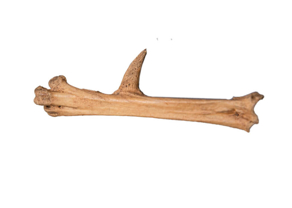
According to Heinrich, even seemingly mundane items often revealed fascinating nuance and detail. For example, Heinrich—who specializes in zooarchaeology—recalls the discovery of a chicken bone with a large spur, indicating that it came from a male. And why might there have been a male chicken at this tavern? A likely hypothesis is that there was cockfighting taking place. Or consider, for instance, the nails.
“So you find nails. OK, so it was a timber building. But they were even more informative than that,” says Heinrich. “When you find a concentration of older nails in one spot and a concentration of newer nails in another, you start to understand the sequence of the tavern’s construction. It got me really excited to know the nails were telling me about a bigger pattern.”
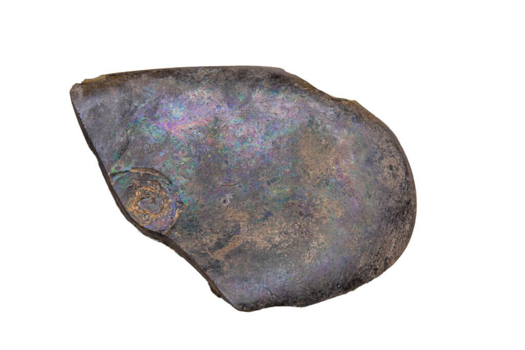
According to Veit, the site proved to be even richer than he’d expected, and was “chockablock full of artifacts” (10,290 to be precise), including everything from the remains of pigs and cows to a puzzling glass seal on the side of a bottle.
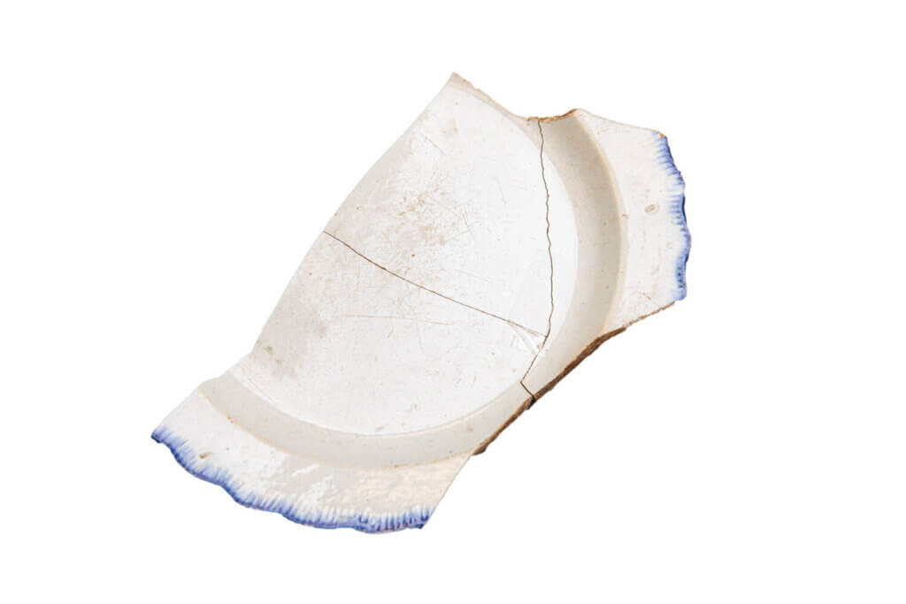
shell-edged pearlware
plate likely used in a
table setting; late 18th
to early 19th century.
“We couldn’t figure it out, initially. But we did some research and realized it was a bottle of maraschino liqueur bottled somewhere in Croatia,” says Veit. “I just thought it was so cool to think of these guys sitting in their bunkhouse drinking this bottle that was maybe salvaged from a shipwreck. Sometimes archaeology is about finding a narrative that’s revealed, and sometimes it’s about stitching together fragments of the past.”
That stitching wasn’t solely about discovering artifacts. It was also about determining the dimensions of the tavern. According to Heinrich, fieldwork began in March 2021 and ran through early May 2021. Every Friday and Saturday, he and his team traveled to the site and slowly, patiently worked to determine as much of the perimeter as they could while also figuring out the tavern’s proportions and internal organization.
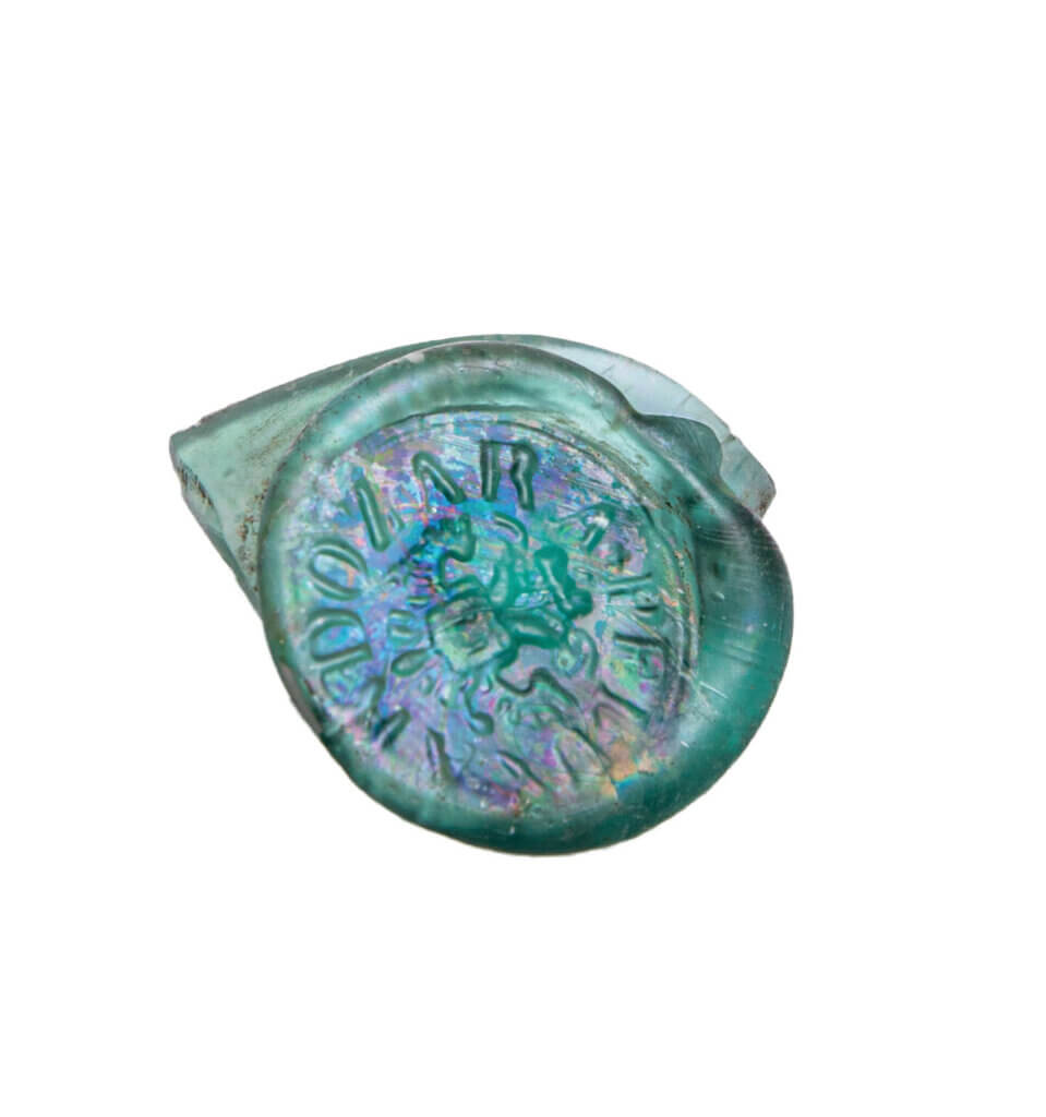
cherry liqueur bottle produced
in Zadar, today’s Croatia. The
double-headed eagle dates
this to 1804 or later.
“We did targeted excavation to learn more about the site that wasn’t done in the 1980s,” says Heinrich. “Back then, they made a map, but where they had drawn a foundation didn’t make any sense. The lines didn’t add up and there were all of these weird angles. So that’s where some of the more traditional archaeology took place and we were eventually able to identify the structure of the building itself.”
For Veit, this was one of the most valuable exercises for the team of Monmouth students who volunteered their time last summer.
“They had an opportunity to participate in a real archaeological excavation here in our own community! That’s a powerful experience,” says Veit. “Archaeology is different than traditional history. We find things that allow us to tell new stories, and our students weren’t just learning about this in the classroom. They were diving into the deep end of the pool and learning how to swim. They also understood that we have one chance at this, and we have to do it right. I was very proud of them, and they left with a whole new set of skills.”
Meanwhile, Fouad and Herrington were stumbling upon surprises of their own. For Fouad, who was “learning about the history on the fly,” his overlaid 19th-century maps gave him a new understanding of the impact humans can have on a coastline.
“I was really surprised by the sudden shift in one area of the shoreline,” says Fouad. “For about 100 years, from 1830 to 1930, it was in the same position. Then, all of a sudden, it shifted 150 meters toward the land. That was striking. Some kind of military installation was there, and whatever happened really destabilized the coast. That in itself shows how the structures we put in the ocean really change the landscape.”
For Herrington, this project was another opportunity to examine the impacts of climate change—not in some abstract, far-distant future, but in an immediate and concrete way.
“I thought my role was important to understand how the system responds to the climate change impacts it’s experiencing, and what we can do to preserve this historic site. I’ve never been asked to do that before,” says Herrington. “There’s a very real chance this site won’t be there much longer, which is a real shame because it holds such significant history for the area.”
In his report to the NPS, Herrington made a few suggestions about how they might best preserve the site, which included the notion of either depositing sand directly in front of the site or placing it into the broader water system, which would feed into the area over time. He also proposed using brush—naturally fallen trees, for instance—to create and maintain breaks to help curb wave energy and currents.
As for Heinrich and Veit, they’re now waiting to hear back from the NPS to see if they’d like further excavation, exploration, and documentation of the site, as well as what they’d like to do about the erosion. Whatever the future holds, Veit says this entire project was simultaneously awesome and overwhelming.
“I think American history is amazing in terms of the stories it encompasses. And this particular site speaks to the development of New York City as a world city, a transportation hub. And also to the challenges that were inherent to travel and transportation at that time,” says Veit. “Thousands of ships wrecked off the Jersey coast trying to get into New York Harbor, and that’s why they needed the Sandy Hook Pilots to go out, meet the ships, and help thread the needle. Without them you’re in real trouble. They used this site as their home base, which really facilitated the growth of cities like New York and, in a sense, helped create the modern world we live in today. And it would have been a forgotten story if not for sites like this. It really is exceptional.”